Magyar
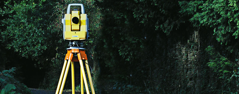

Technical inspection and on-site measurements of engineering facilities and hydraulic structures
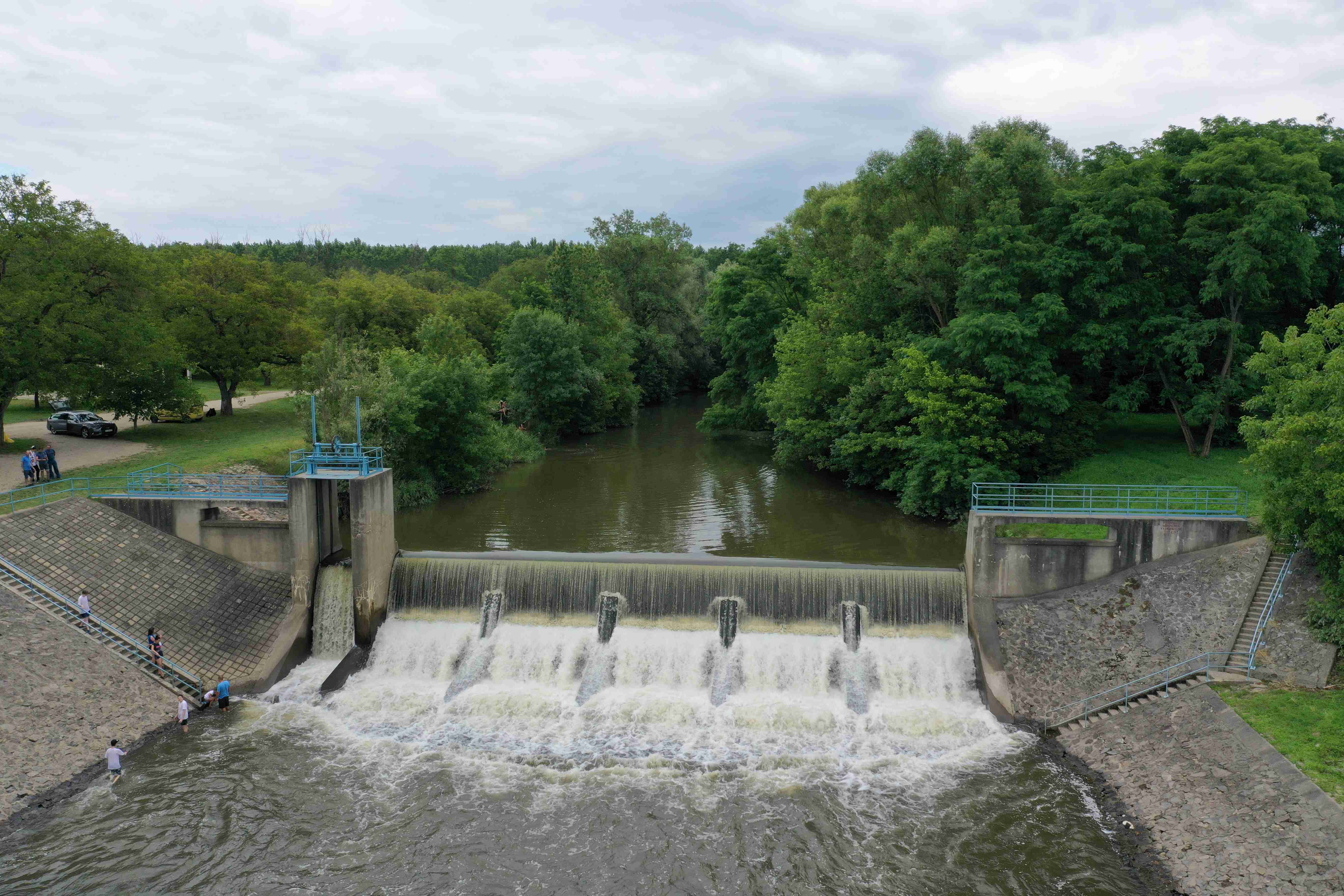
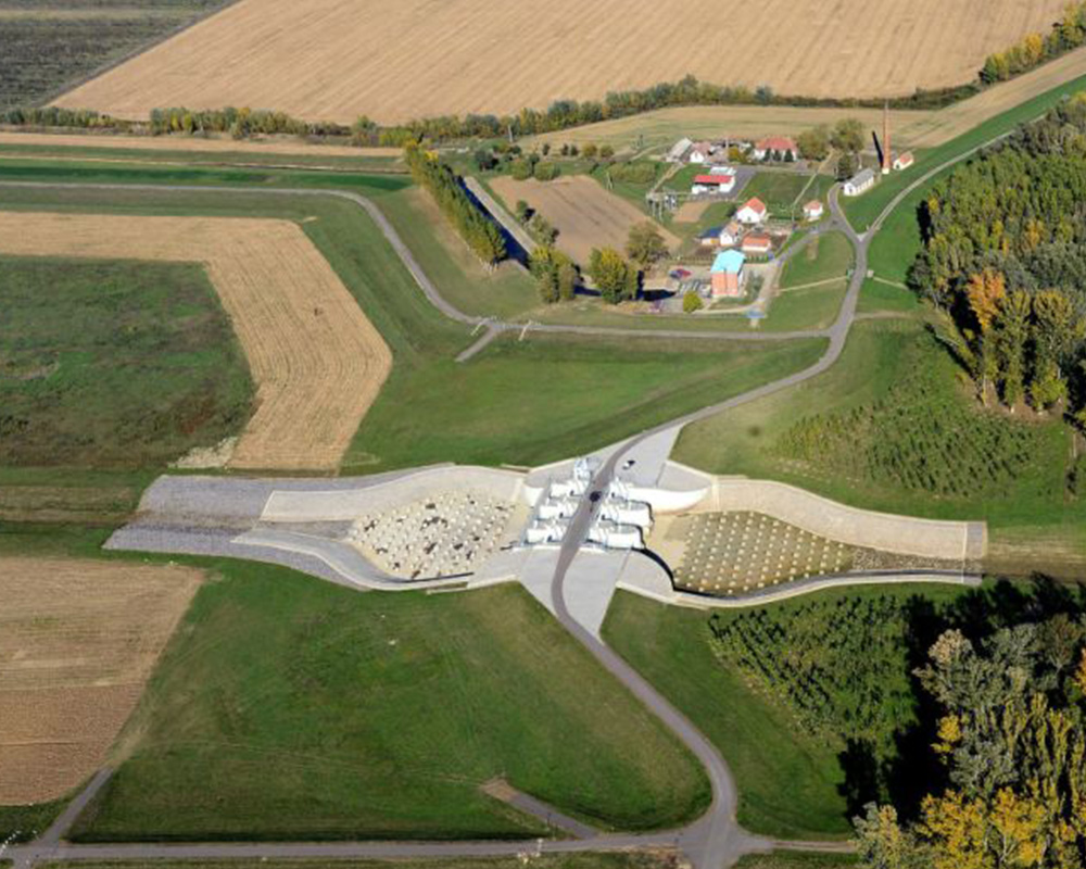
Based on its employees’ vast experiences, VITUKI Hungary Engineering Office Ltd carries out regular technical inspections of hydraulic engineering structures. Tracking changes ensures the continuous and safe operation of the structures, as well as the early sensing of potential malfunctions and the economical implementation of maintenance and intervention works. Our main activities include regular and periodic technical inspections of river barrages, dams, ship locks, sluices, structures across levees and hydroelectric power plants.
The inspection work consists of:
- stability investigations (investigation of relative and absolute motions)
- hydraulic investigations (investigation of riverbed changes and flow conditions)
- investigation of pressurized systems (flow parameters, pressure conditions, discharge measurements)
- material testing (checking state and testing strength).
Certain special tasks (calibration of measuring structures, statics checking, seepage investigations, status-checking of hydro-mechanic equipment etc.) are implemented with the help of investigation methods developed by our experts. The accuracy and credibility of the measurements are ensured by our calibrated and regularly inspected instruments.
Vertical and horizontal displacement measurements, concrete investigation
Water management planning
- Elaboration of municipal water damage control plans
- Sizing and designing the downstream beds and damping pools of large river structures and emergency reservoirs by identifying the flow requirements of bed stability
- Elaboration of environmental impact studies, strategic environmental evaluations, elaboration of the environmental protection chapters of municipal development plans
- Compilation of environmental and legal licensing documents
Water management and environmental protection planning
Expert works
Expert and qualification works
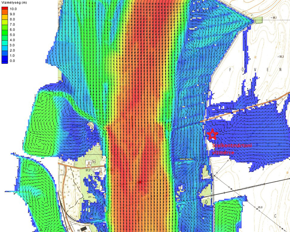
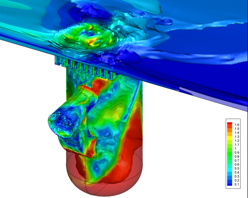
Numerical modeling
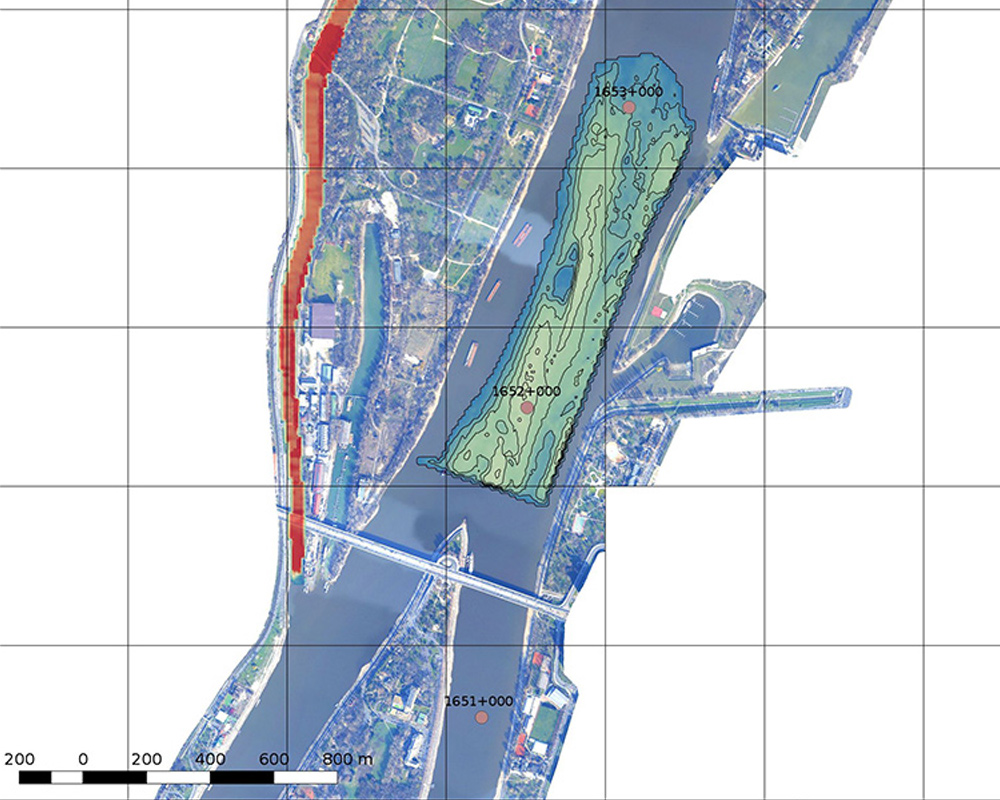
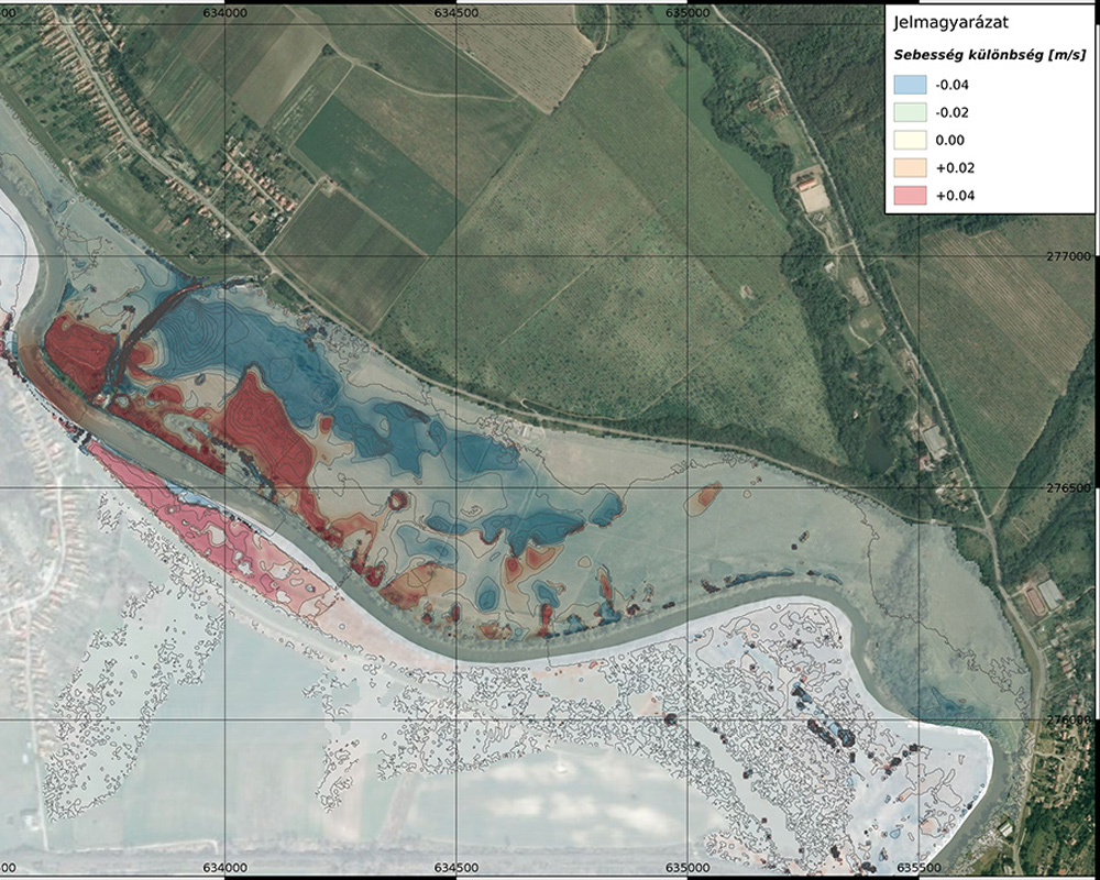
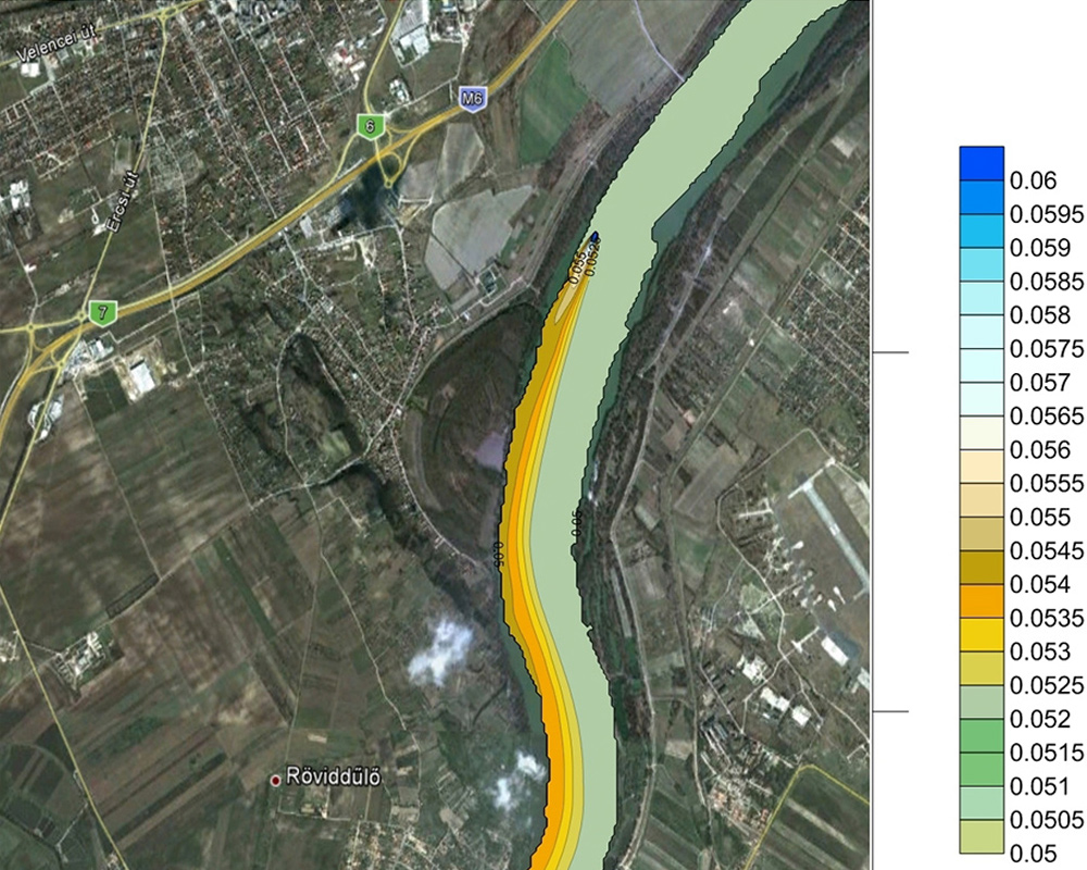
- Development and application of hydrodynamic and river morphological models (1D, 2D, 3D) for analyzing flow and bed morphological processes in surface waters under low-, mean- and high-water conditions.
- Development and application of transport models (1D, 2D, 3D) for analyzing mixing processes in surface waters (heat loads from power plants and from thermal water uses, transport of suspended sediment and bedload, transport and reaction-kinetics of nutrients, toxic substances etc.).
- Modeling rainfall-runoff and nutrient transport processes in river basins, for supporting river basin management and water quality control planning. Development of flood forecasting systems with the help of rainfall-runoff and riverbed-runoff models.
- Modeling the process of wastewater treatment in wastewater treatment plants
Numerical modeling (hydrodynamic, hydrological)
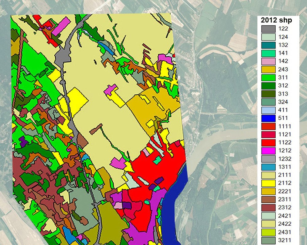
Geoinformatics
Remote sensing and GIS
Research and Development (R+D)
Development of flow theory, sizing methods and forecasting systems
Informatics services
- Hydrological and climatological statistical analyses
- Design, construction and update of databases
- Flood risk mapping, flood management planning
- Development and application of forecasting models (hydrodynamic, hydro-morphological, flood control, water quality control, rainfall-runoff)
Statistical analysis, database development, flood risk mapping